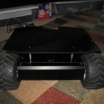
 In a joint effort between my girlfriend and I, SAGAR now has a super fancy LabView based graphical user interface. The video below is a screen capture of the interface as SAGAR runs a mission taking it around a parking lot. All communications are in the form of NMEA sentences. The DIYdrones ground station gave us a few ideas of what we wanted to do.
The terrain isn’t actually that rough, SAGAR’s orientation sensor is just noisy. I’ll have to take a look at it later. The current position of SAGAR is plotted real time on Google Earth, as well as the current WayPoint goal.
Watch the video on Youtube here.

